Durango, Colorado and many other nearby towns are considered “mountain towns” and high-altitude locations. Whether you are planning a visit or considering a move, it’s helpful to understand how a change in elevation can impact your body, as well as the surrounding real estate.
What is Elevation?
Elevation is simply the height of a physical location above sea level. It is typically measured in feet (or meters) and commonly in fields like geography and topography. As elevation increases, atmospheric pressure decreases, making the air thinner and colder. An altimeter is used to measure elevation and altitude but today, these measurements are readily available online, GPS, Google Maps, and topographic map contours.
Although often used interchangeably with “altitude”, the terms have a subtle difference: elevation refers to places (like towns or mountains), while altitude can describe or qualify objects above sea or ground level, for example a plane or high-altitude training for athletes.
Durango’s Elevation
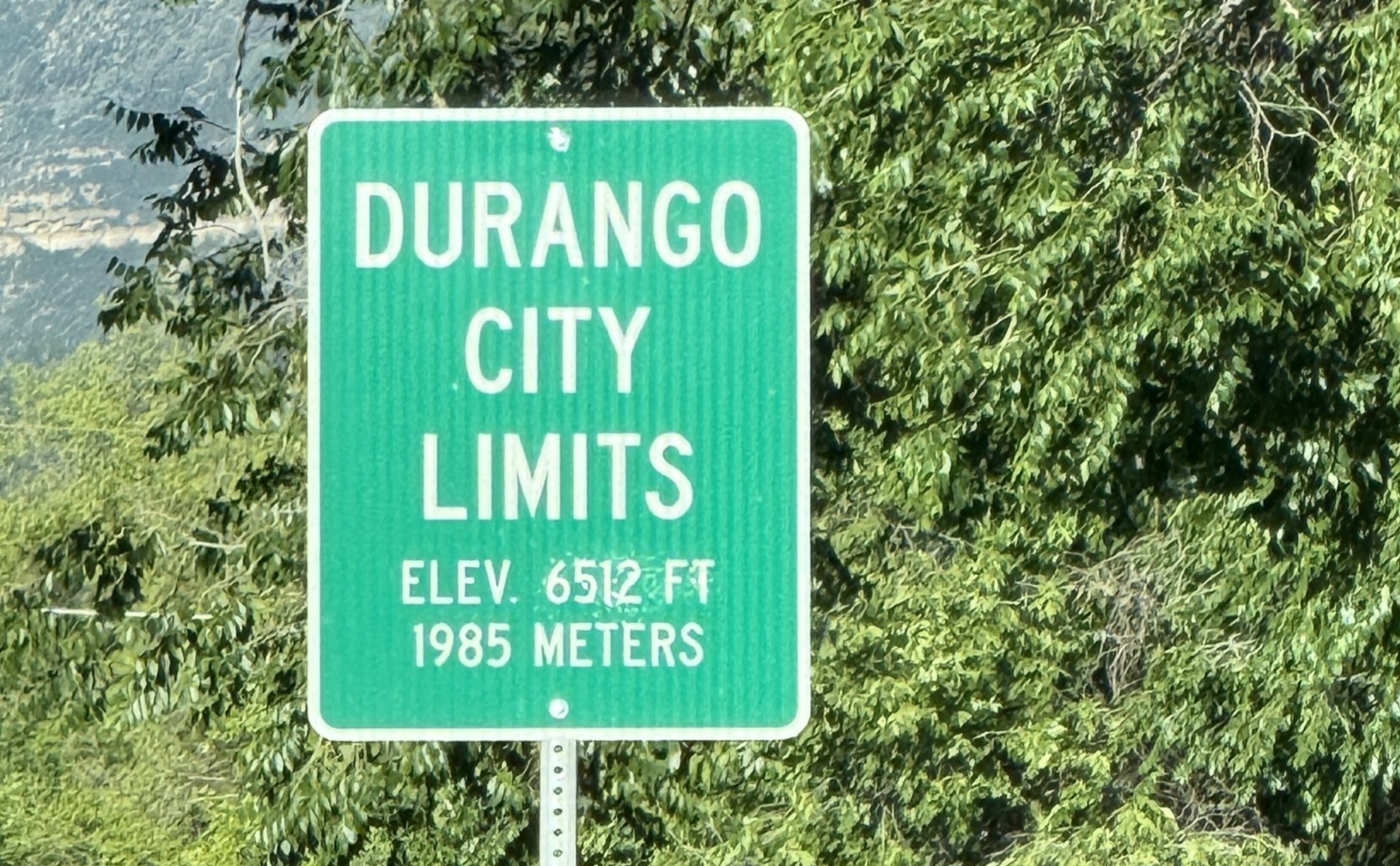
Durango’s official elevation is 6512 feet, although it can vary depending on exactly where you are in town. You’ll often see this number featured on souvenirs and used by many local businesses. As elevation changes, so does the environment. The climate, vegetation, and wildlife all shift with altitude. Some species can only survive below a certain altitude, like the Saguaro Cacti which can only grow under about 4,000 ft. On the opposite end, the alpine treeline, where trees stop growing due to limited oxygen and nutrients, is around 11,500 feet.
Surrounding Area Elevations
Nestled in the Rocky Mountains, Southwest Colorado has a large range of elevations, from Silverton, CO (45 miles north of Durango) which sits at 9,302’ to Farmington, NM (51 miles south) which is 5,394’. Farmington is hotter and more desert-like versus Silverton which experiences colder weather and is surrounded by rugged mountains.
And of course, Denver, Colorado is known as the “Mile High City” sitting 5,280’ above sea level.
How Does Elevation Affect People?
Because elevation changes the atmospheric pressure, it can affect humans, weather, plants, and even baked goods.
Altitude Sickness
One of the most common concerns when enjoying our mountain areas is altitude sickness. This occurs when someone ascends too quickly, typically above 6,000’ to 8,000’, without allowing their body time to adjust to the lower pressure and oxygen levels. The summit of Mount Everest stands at 29,032’ and requires training and acclimation. In comparison, flying in a plane at nearly the same altitude, doesn’t cause altitude sickness because the cabin is pressurized.
Altitude sickness symptoms usually include headaches, nausea/vomiting, fatigue, dizziness, shortness of breath, and malaise. Luckily, it’s generally avoidable and treatable by staying hydrated, easing into physical activity, and allowing time to acclimate, but it’s important to monitor it as the condition can worsen and be life threatening. Alcohol is also processed by the body differently at higher elevations.
Sports Training
Because the air is thinner at higher elevations, some athletes train in these conditions to build endurance and improve oxygen efficiency.
Baking
Even bread and cupcakes are affected by altitude science! Above 2500’, air pressure and oxygen levels can change how baked goods rise, set, and retain moisture. Results can include dryness, gummy textures, and collapsed goods from them rising too quickly. Increased oven temperatures, lower baking times, sugar and leavening deductions, and added liquid and flour are common tips used for high altitude baking.
How Does Elevation Affect Real Estate?
Southwest Colorado’s diverse elevation and rugged topography make it an important factor in purchasing real estate. Higher elevations often offer amazing views or gorgeous tree cover, but may experience more extreme weather, more challenging building conditions, and limited usable land. In some cases, only a portion of the acreage is suitable for the building footprint, the rest may be too steep, rocky, or in a floodplain. Soil types, geology, water, and ease of access can work for farming and other agriculture uses, while excavation in other areas may be extremely difficult due to the amount of rock and granite in our higher elevations.
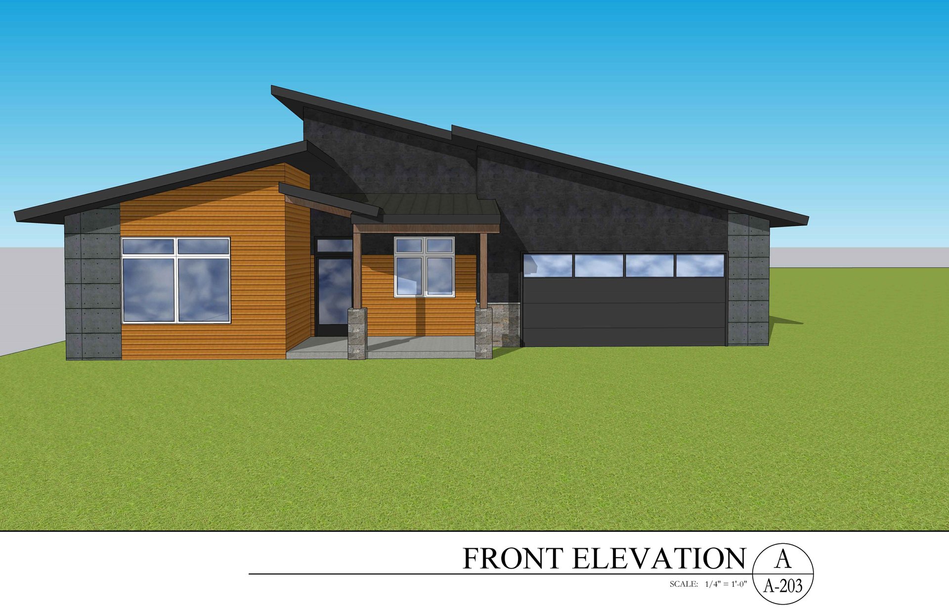
Elevation in Building Plans
The term “elevation” is also used in building plans, showing the exterior view of a building from different vantage points (front, side, back, etc.). These plans show the exterior finishes; placements of windows, doors, rooflines, etc. and help architects, builders, and homeowners visualize the finished structure.
Whether it’s your oxygen levels, your brownies, or your building site, elevation matters - especially in Durango and throughout Southwest Colorado. Have questions about elevation, land use, or Durango Real Estate? We’d love to help, contact us anytime for more information!